CHARACTERISTICS

Customizable logos and backgrounds

The login page can be customized with a company logo and background. On the internal pages, the logo is linked to the institutional home page to better characterize the product.
ologo
ologo

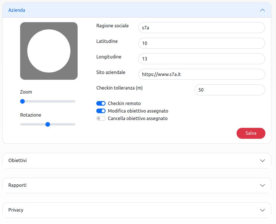
Fully configurable environment

The product is fully configurable on the needs of the company. For example, it is possible to set the default geographical coordinates to allow an accurate calculation of the routes starting from the reference site.

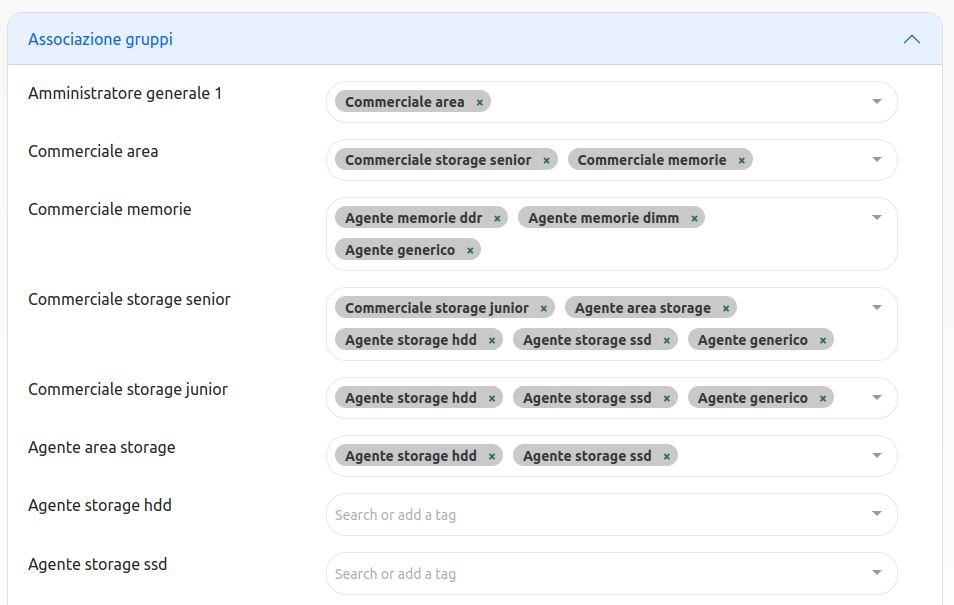
Hierarchical user management

User management is granular and hierarchical.
Each user is assigned a role and one or more groups that determine the operating space within the application.
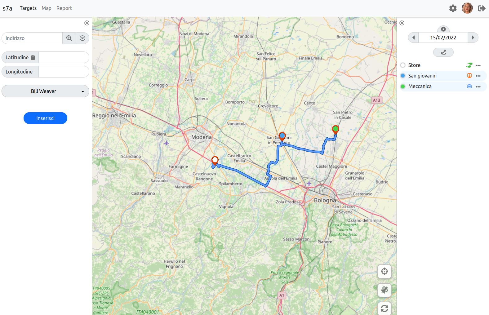
ologo
ologo

Target management

Each user manages the objectives of the direct collaborators . It is therefore possible to logically separate different operating sectors , resulting in a closer view as you lower your level. So the area managers will only see the objectives of the areas assigned to them.

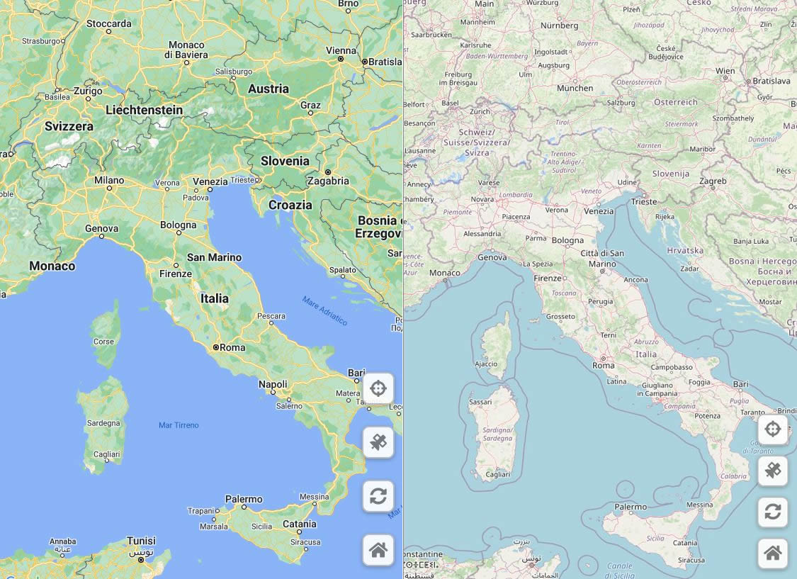
Use of Google Maps or OpenStreetMaps

The system includes support for Google Maps and OpenStreetMap . The choice of the type of map is made on the basis of the client's operational needs and budget. In fact, the former provide for a cost related to use, while the latter are completely free but may present results with a lower level of detail.
ologo
ologo

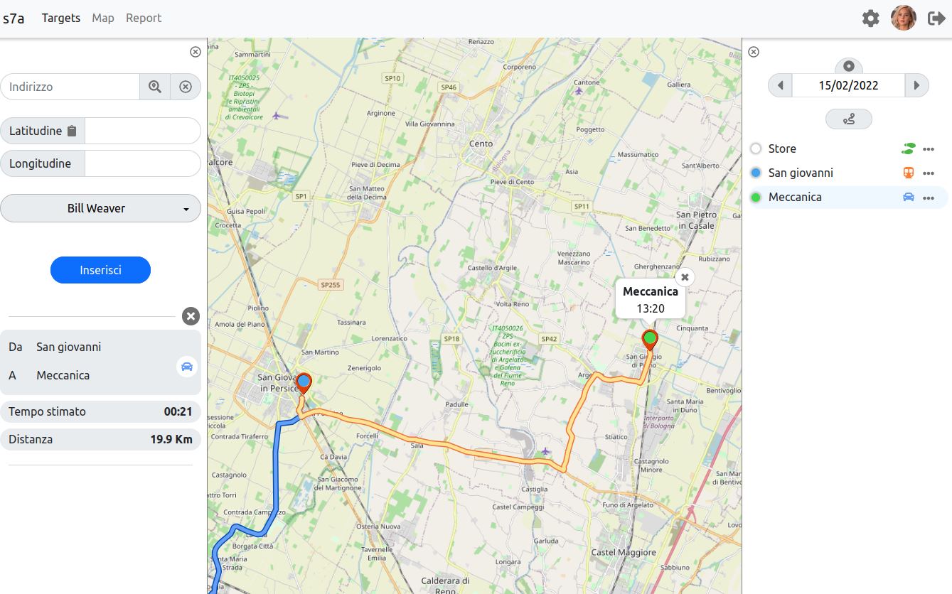
Detailed and interactive list of the objectives of each operator

The objectives of the selected day are presented for each operator. The detail of the goal , the assigned means of transport and the status are shown. The list is sorted according to the scheduled time for the meeting. The map automatically adapts to the chosen goal, giving precise information on the route, distance and expected travel time.

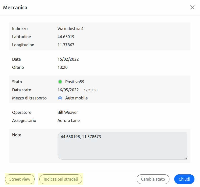
Link to Google tools

Regardless of the type of map chosen, it is possible to use the links to the Google tools to obtain additional information with respect to the many provided by the webapp.
For example, it is possible at any time to use the link to the StreetView 3D by Google to get the details of the chosen destination. The system automatically passes the geographic coordinates to the Google tools in order to arrive immediately at the point of interest .
ologo
ologo

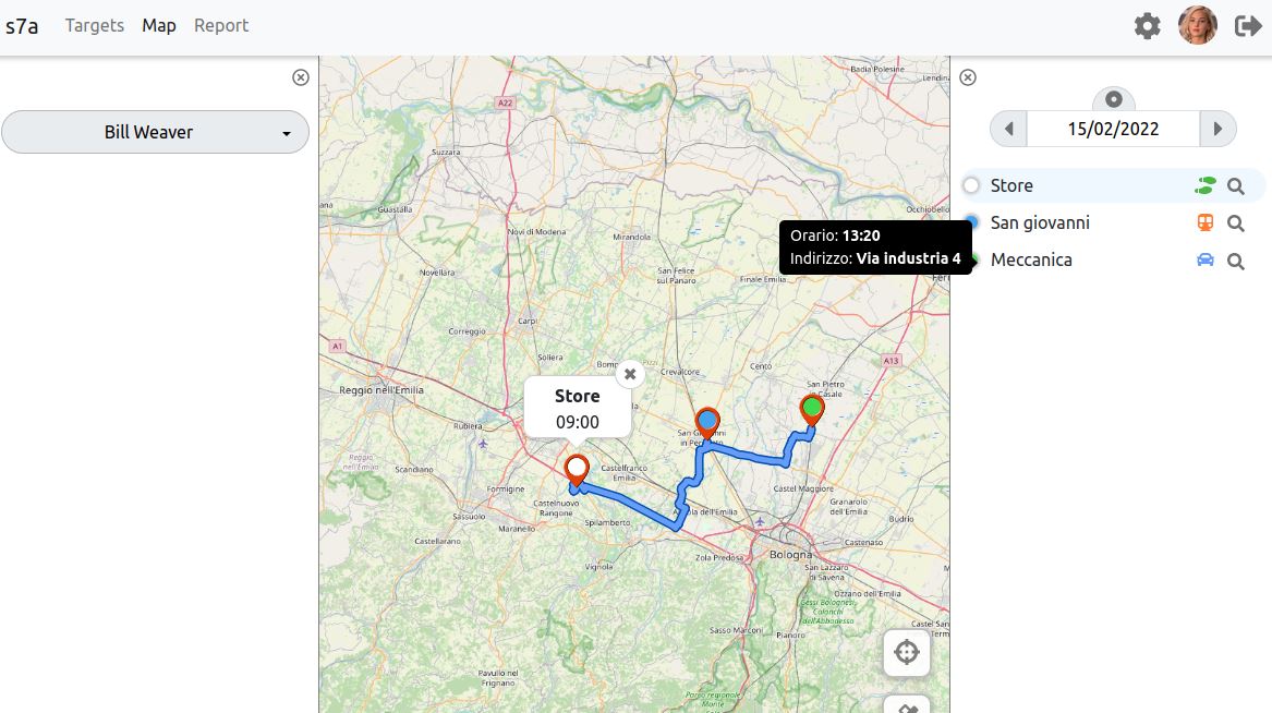
Calculation of routes based on the time of the appointment
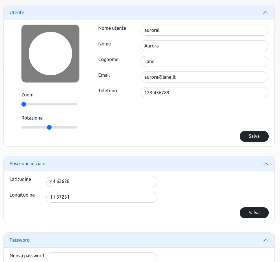
The routes are sorted based on the scheduled time of the appointment and according to the means of transport indicated. It is possible to indicate mixed routes : for example, the first objective is reached by car and the following one on foot and by public transport. In this case the route is calculated on the map taking into account all the specificities.

User card

Each user has the opportunity to enrich their personal file with useful information. For example, it is possible to indicate a starting position other than the headquarters or define a custom avatar .
ologo
ologo

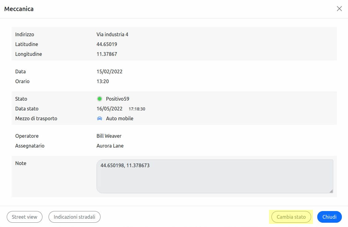
Possibility to intervene on the status of appointments

The area manager has the possibility to intervene on the details of the objectives assigned to direct and indirect collaborators. For example, it is possible to change the status of an objective if this is incorrect or undefined.

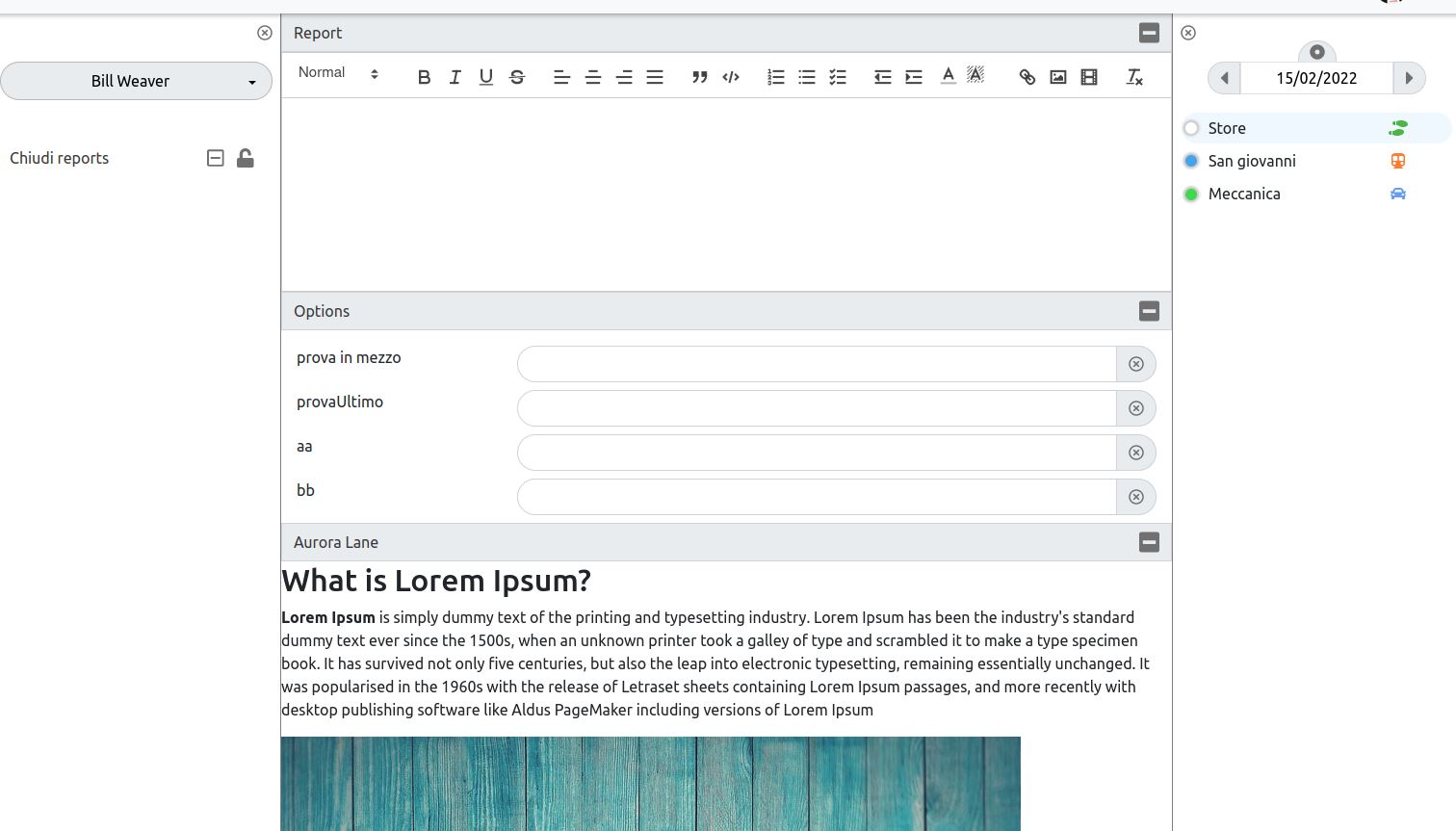
Collaborative drafting of reports

Each goal is associated with a report divided into sections, each for each operator involved . In this way, it is possible to provide the final operator with some preliminary information or to define the endnotes.
ologo
ologo

Complete editing with text, images and multimedia elements

The report provides for the management of formatted texts and images. It is also possible to define personalized cards that help the operator to provide the information deemed necessary.
 

We value your privacy

X

We use technical cookies for the operation of our site, including functional cookies (to enable certain features and store your preferences) and analytical cookies (to conduct analysis on visits in anonymous and aggregate form). Some cookies are optional and are used only when you have consented by clicking on “Allow all.” You can manage your preferences through the "Change settings" button, confirming your choices using the button "Accept selected cookies".

TECHNICAL COOKIES

These cookies are necessary for the website to function properly.
By denying consent, some parts may not function properly.

We use functional cookies to enable specific website features and to configure the website according to your choices, such as the cookie settings themselves.
We also use third-party cookies, or similar technologies such as pixels or tags, to collect information and statistics on the navigation of our users. For this purpose we use a service of Google LLC, Google Analytics. These reports contain aggregate information about users and do not identify users individually. In addition, Google LLC guarantees us that they do not combine the information collected through cookies with other sources to identify users or forward this information to other third parties. We follow the guidelines of the Italian Data Protection Authority in order to anonymize the tracking by these cookies and according to these guidelines we consider these cookies as technical cookies.

PROFILING AND SERVICES

These cookies can only be installed with your consent.
They record your choices and activities on our website to personalize the services offered. By denying consent, some parts may be excluded from navigation.

Google reCAPTCHA is a SPAM protection service provided by Google Inc. Use of the reCAPTCHA system is subject to Google's privacy policy and terms of use.
CHANGE SETTINGS ALLOW ALL
Loading...